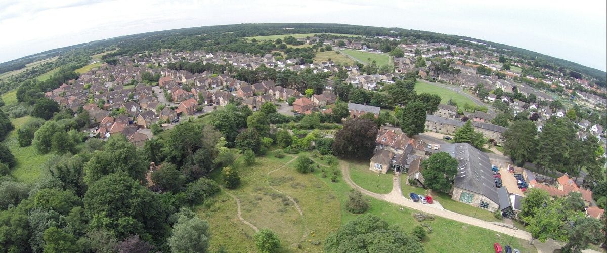
The urban sprawl
Gavin leads the BTO’s Terrestrial Ecology team, which currently comprises up to 15 analytical and field research staff, conducting and supervising pure and applied research on terrestrial bird ecology.
Relates to projects
The British countryside is under more pressure from development than ever before. Urban areas are sprawling out into former Green Belt land, for example, and recent changes to planning legislation are set to make this process easier for developers. Numerous ‘garden villages’ are among the developments that are in progress, but it seems inevitable that even more of the countryside is going to be built upon. Meanwhile, there is increasing evidence that people receive health benefits from exposure to nature, such as seeing and hearing birds, something also evident in reports highlighting how gardens and their birds helped a range of people through coronavirus lockdowns.
Urban areas are where most people live and, as a consequence, where they have the most potential to experience wildlife. Habitats associated with humans (such as gardens and parks) also host high densities of many species, including Blackbird, Goldfinch and Blue Tit. Making these habitats more wildlife-friendly, but from the perspective of the benefits for people, would be a valuable new focus for conservation.
Nature and greening artificial habitats
There are obvious conservation priorities in preventing urbanisation from destroying or compromising sensitive habitats and rare species. These are, broadly, well-covered by planning legislation (for now at least). In most developments, however, we see countryside (predominantly farmland), which is not necessarily ‘natural’, being replaced by another artificial environment in the form of houses in towns and villages. The key environmental question here is then not “how can we retain nature in new developments?” – the Skylarks that live on farmland will never live in a housing estate however nice it is – but “how can we make new developments better for nature?”. If we can do this effectively, then we can increase the amount of exposure to nature that people receive by making it more accessible to them, and therefore perhaps improve their well-being and interest in the natural environment.
‘Greening’ built-up areas is not a new concept: new developments today all include some green space and aim to be sympathetic to existing landscape features, such as rivers or copses. However, plans are based on general principles, such as aesthetics, rather on detailed data about the environment that people might expect to experience in developments that are planned in different ways. This is where volunteer data come in, specifically data from the BTO/JNCC/RSPB Breeding Bird Survey (BBS).
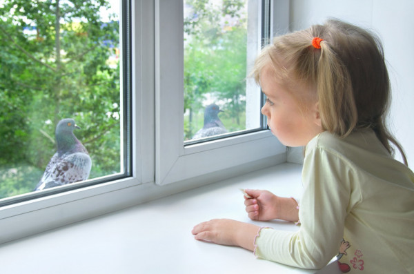
Urban areas are where most people live and, as a consequence, where they have the most potential to experience wildlife.
BBS counts and the urban landscape
BBS data are mainly collected to tell us about long-term changes in bird populations, but they can also tell us how habitat features, including those urban landscapes, affect how many birds are found there. So, in a recent study led by my colleague, BTO scientist Kate Plummer, we analysed how bird numbers in built-up areas – from villages to cities – are affected by the characteristics of those urban areas.
We combined BBS counts with high-resolution data on urban land-use from Ordnance Survey mapping and satellite imagery. This helped us to describe landscapes in terms of features like the percentage cover of buildings, gardens, parks, greens, woodland and water, the sizes and numbers of these areas, and the variability of ’green spaces’. Together with data on the features of the wider landscape around the urban area, such as the type of farmland and how much woodland there is, we analysed this information using statistical models, which showed how different landscape features affected the number of birds that had been counted. The results show that all bird species respond differently to urban habitat, and that few features consistently affect a large number of species. This shows that we cannot analyse bird community variation effectively with simple indicators like an average trend: any such composite index would hide a lot of species-level variation that is likely to be of interest, say if House Sparrow increases but Song Thrush declines. Nevertheless the results did show that most individual features were important for multiple bird species. The most important ones were larger areas of green space (instead of small patches), less building cover and measures of the diversity of types of green space. More importantly, the relationships between bird numbers and features of the urban landscape that the analyses revealed predict how bird counts vary overall.

Making planning work for birds
This project shows that predictions from statistical models of BBS data have the potential to inform urban development. For example, the implications of a planned development, with large green spaces and small gardens, could be compared with those of another that just has large gardens. The models could also be used to show how managing green space as scrub or woodland, as opposed to amenity grass, would have on bird numbers. Planners, developers and landscape architects could use the models to compare different options for building new housing estates or industrial areas in terms of their consequences for birds. Of course, with any planned development, there are many other considerations to take into account. However, birds and nature are relevant for human health and could also contribute positively to the ultimate financial value of new properties.
The next step, to move from our results to tools for planners, is to show prediction in practice, by developing the statistical models to show the effects on birds of real new developments that are planned around the UK and what the effects of alternative designs would be. This work is now in progress, led by Joe Cooper, another member of the Terrestrial Ecology team at BTO.
At a larger scale, well-designed urban developments could soften the ecological impacts of urbanization. Ultimately, the statistical models could also inform the process of biodiversity offsetting, in which developers are required to deliver management elsewhere that compensates for the net negative effects on biodiversity of new builds.
Not just birds
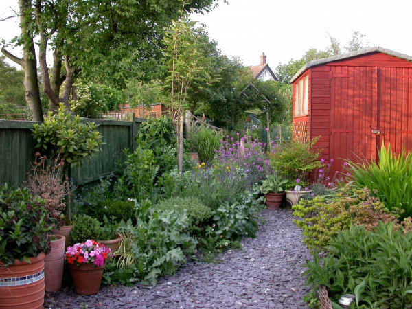
Although birds are good indicators of the overall quality of an environment, and one of the most conspicuous elements of nature for most people, other wildlife is clearly also important. There are challenges in choosing vegetation to grow around new developments; for example, while native plants will almost always be a better choice to support other native species, gardeners often prefer exotic plants for aesthetic reasons. However, the recommendation to support biodiversity better is obvious. Among other animal groups, equivalent statistical models to our bird ones could be constructed for butterflies and bats, because high-quality surveys are done each year for these groups. Future work will develop these models.
Landscapes and gardens
Taking nature into account in urban design is important at other scales as well: where should new developments be placed in the wider landscape? BTO Bird Atlas 2007-2011 data can tell us about the landscape scale and relationships with bird distributions. BTO Principal Data Scientist Simon Gillings has analysed how different species’ distributions are related to the density of human populations. His work confirmed how species like Skylark avoid densely populated areas, while species like Feral Pigeon thrive there, but others, such as Song Thrush, were most common in suburban areas. Then, at small scales, how can we best manage gardens for birds? BTO Garden Bird Watch data can tell us how bird numbers are affected by different features in gardens, so we plan to do new analyses to show, for example, how different species benefit from the presence of dense shrubs, berry-bearing plants, ponds or lawns.
An app for urban birds?
If the models for birds and other groups are going to be used by planners and the like, we need them to be as accessible as possible and user-friendly. One way of doing this is to present them in an online app. Ideally, a planner would be able to enter a map of their plan for a new development and then edit it as they see fit, trying different combinations of buildings, open grass, woodland, water, etc., and seeing the consequences for birds that the models predict. This would deliver a new, practical use of BBS data and make model results easily available to a new audience.
To make this work best, we would need to work in partnership with end-users, to make sure that the app meets their needs. There are clear benefits for planners, and for society in general, to work with the conservation sector in this way, so we just need to convince them that it is the case….
Share your thoughts on the potential app, and more, in the comments below.
The Urban Appeal - making space for birds
You can make a difference to the way humans and birds live together.





Share this page